Welcome back to the Solution Series brought to you by DoubleRadius and hosted by Jeff Holdenrid. Today we have wonderful guests from Cambium and today we are going to talk about CNHeat.
Gentlemen, could you please introduce yourself?
Ghabra: Sure, my name is Jihad Ghabra. I am the Product Line Manager with Cambium. I manage the EPMP and I also co-manage the QOE and right now I am new to CNHeat and Link Planner.
Poche: I am Seth Poche. I am a Technical Lead for the CNHeat for RF Planning Tools, in general but specifically for CNHeat. I have been there since day 1 and trying to figure it out for everyone.
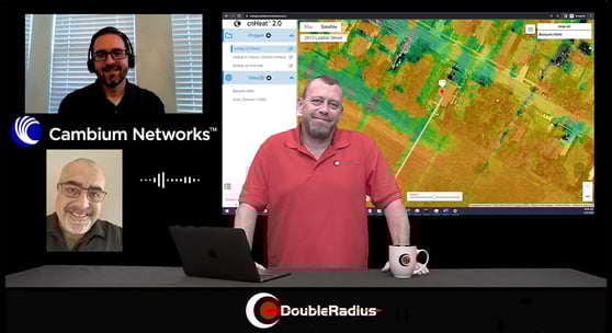
Today we are going to talk about CNHeat. It is a powerful tool, and something I have used quite a bit. It is a great propagation tool, but can you give our viewers a quick overview of what CNHeat is?
Poche: CNHeat does heat maps. It is different from most tools in that it uses very high resolution data. What we kind of knew, was that overtime one of the hardest things to do, especially in 5GHz, is to predict that 1 tree that might be in the path that is blocking the signal. Without really high resolution data it is hard to make that prediction. At the same time how do you note that the tree is there? Lidar data has been released, and it is incredibly accurate. An airplane will fly overhead and it will send out 2oo,ooo pulses per second of laser, and as the pulse goes out it is measuring things. We are able to get this true 3D picture of what the landscape looks like and no matter a tree, a home, or whatever it may be that is an obstacle or obstruction, we get to see that in the model. It lets us be able to model in ways we have never been able to model before with a really high level of accuracy and precision and confidence that we have not been able to have before.
I know there are a lot of different terms that are used in propagation studies, I know you guys use clutter data in Link Planner, in this you are using lidar data but could you explain to everyone the accuracy of lidar data or the differences between the two?
Poche: The lidar data that we get is usually from public sources, it is usually just a few centimeters of accuracy. We actually down-convert it to 1m resolution. We don't ever know the quality of the lidar data that we get, sometimes it is encoded with different information. It might already have classification, it might have various intensity things. We never know what we are going to get so we generalize our lidar so it is all the same going to the tool. We "downconvert" to 1m but the underlying data, which shines through a lot, is usually within a few centimeters. If they are showing the top of a tree at 30 feet above ground they are typically seeing that within a few centimeters and that is the beauty that gets carried over.
CNHeat is not a new tool, it is something you have had for awhile, so how did it all come to fruition?
Poche: It started with an internal mandate. We were having trouble with customers that were new to Cambium were struggling to understand what they could expect from equipment, especially in the 5GHz range. We had some customers that were deploying in the 5GHz and using it in a scenario that would be considered near line of sight or non line of sight, it wasn't going well for them. They were coming back to us asking “If I am doing it wrong, tell me how I am doing it wrong.” and we were left with a problem where traditional tools just will not show you accurately what will and won’t work because your modeling generalized trees not exact trees in reality. That is what led to it, asking how we were going to solve this problem. Lidar was the solution. It brought its own challenge in that it is incredibly difficult to process at this resolution, but that is kind of where we have been in this journey in how to take the lidar, process it, and make these accurate predictions.
I know CNHeat covers a lot of different frequencies, can you get into what frequencies we can propagate in CNHeat and show real world scenarios?
Poche: Today we support between 2GHz and 6GHz for our standard heat maps. We haven’t included anything below 2GHz at the moment because we have a 1m resolution, again these are really detailed heat maps, limited range to 8 miles. A lot of times that is not very useful if you are considering 900MGHz or something like that. Today we support 2-6, we also support 28GHz and 60GHz.
Talking about all those frequencies (CBRS and 3GHz) does this also model near and non-line of sight?
Poche: That’s right. We have grown. The first release of CNHeat only did line of sight and now that we have released CBRS we have released non line of sight. So now we add non line of sight capabilities to all of our predictions that run, all that are 6GHz or below. 6GHz or below will automatically run line of sight and non line of sight at the same time.
That is really cool when you look at the differences from near and non line of sight with all the different maps that come out with the non line of sight. So, now, with CNHeat you have CNLocate and also the CNIdentify, could you explain the differences between the two?
Poche: We have two different components of CNheat today; we have locate which is actually heat map and Identify which is the buildings and the addresses. Not only can we do a heat map which is incredibly valuable. But we can also do this Identify. In Identify we can load the building footprints and pair it to the coverage to give you the latitude and longitude of every building that is covered, or we can send that off to a 3rd party to get the cast-certified addresses so you know they are going to go through the USPSs and send them back to you. You could use those for marketing or any other verification that you do cover certain locations.
Ghabra: Perhaps Identify is used for an AP, if you would like to know what is the best location for an AP Identify is what to use.
Poche: Yes, Identify will show you all the various places that you can connect and so having that and having that related to your various APs could be very useful.
What I am hearing is if you put the two together as a wireless service provider I could use CNLocate to see my coverage areas to, find out if I am deploying in the right areas to server the ares, then I could use CNIdentify to take those addresses and focus my marketing efforts on the people that I can actually connect to and sign up today without burning time with the ones I might not be able to serve today. Is that correct?
Ghabra: Exactly.
Poche: Exactly.
So really it is work smarter not harder, spend a few dollars now making a smarter investment on your future, and grow exponentially on that. I like that. Now that we have a seen a few trade shows this year and we have heard you guys start hinting and talking about what is going to be called CNHeat 2.0, could you give us a little bit of an explanation and the differences between the original model of CNHeat and what 2.0 will bring to the table?
Poche: In 1.0 we spent a lot of time working on the tools needed to do these really difficult calculations. They were internal tools that we were writing, unfortunately they were hard to use and we could not just release them to our customers. In 1.0 if you wanted to run a prediction you had to provide a spreadsheet Link Planner project, you had to send it to us to process on the backend with our production team before we could send you the results. What we have done with 2.0 essentially is we have capsulated those tools and put them in a web-front end for users to run predictions, they do not have to rely on us. Once we process the lidar front area they can go out and run their own predictions and do their own “what if” scenarios.
So really now it is going to be a user-friendly application that won’t rely so much on sending us information or on us chatting as much?
Poche: Unfortunately.
I am really looking forward to playing with 2.0 and seeing all the ins and outs of it. Now we know the WISPs are going to benefit from this powerful tool, what other markets or solutions do you see that could benefit from using CNHeat and 2.0?
Poche: WISPs are definitely our primary target, but we do see a lot in industrial and oil and gas. They are going out and spending a lot of money and investment having to know it works. They are covering large areas, you do not want to go into a site survey for everything. We also see a lot of uptick in CNHeat when it comes to funding. Anytime you apply for a grant, or anything like that as a WISP or educational purpose (with COVID we had the CARES Act), that is going into making sure people were connected you want to be able to show with confidence that you are going to be able to pull off what you are saying. We have a lot of customers that have come to use looking ot apply for a grant and needing to show what they can do. At that point is not just about handing over something that looks good so you get the funding, but it is really that you are not trapping yourself or signing up for something you can not commit to. There is a lot of peace of mind for these operators when they sign up to CNHeat for that purpose.
When we move into 2.0 is this going to be priced out as a subscription service, a pay 1 time fee, or how is that going to be done? I know 1.0 was done per tower basis, how is 2.0 going to look as a subscription or 1 time fee?
Ghabra: All of our products right now for CNHeat are basically subscription, you purchase it for a particular term. The term we offer, besides 60GHz, is 1 year, 3 years, or 90 days. The 1 year and 3 years there is an option of paying it upfront, or paying it in quarterly installments. As far as 60GHz is almost a mirror image of the top, but it is a different part number.
That is a great explanation of how it will be priced out. The reason I am asking you to go through that is because we use this tool all the time and share this tool with our clients showing them the power of it, when we price it out they literally jaw drop. They can not believe how cost effective it is for this tool. That is very helpful for the client.
Now we know CNHeat is Cambium Networks and we know this works with all the products Cambium offers, but there are a lot of manufactures out there that create LTE gear, 5GHz gear. Could this actually be used to show propagation, Locate, or Identity for other manufactures or other products available today?
Poche: For 6GHz and below we are very much vendor agnostic. As long as we can get an antenna pattern for a sector of the tower side we can import that into our system and we are happy to do that to let customers run their own equipment. We hope that CNHeat shows the power of the Cambium equipment but we recognize not all of our Customers use Cambium. When it gets to 28 GHZ and 60GHZ it is a little bit tougher, those products have a little more secret sauce in them and it is a little harder to model them without knowing what is going on behind the scenes. So, for those 2 products we only offer Cambium equipment, but for everything 6GHz and below as long as we can get an antenna pattern we are happy to support whatever customers want. We are very much vendor agnostic.
Is there anything we are missing, or that the viewers need to know about CNHeat?
Ghabra: It is a great product.
Poche: For more experienced guys to be able to accurately predict, especially in a prequalification situation where you are trying to determine if you need to roll a truck to a particular location, it's great. People have been burned before and they don't believe there is a good product out there that will do this so they kind of go back to their own experience … I would say to try it. We offer demos for new customers, they just need to fill a form out. We can give a demo site or run it on a site you already have deployed and compare to what you already know to be there, or installs that have been successful or failed. We believe you will be pleasantly surprised.
Ghabra: The bottom line is you can either spend a lot of money trying to figure out where the location of an install is going to be, or you can use softer tools and save all that money and know where to install very accurately. Or perhaps optimize installation. And, also from a marketing perspective if the WISPs know the addresses of where to target their market that is a great saving!
That is all great information. I have been using this tool for awhile now and it is very powerful. I highly recommend that if you haven't used it, fill out the demo form, reach out to your sales rep to discuss pricing, and talk about the solution it is. It is almost like they should have called it “CNCrystalBall” because you actually get to see exactly what you are going to deploy, what it is going to look like, and the success you are going to get from that area before you even get there. Use the tool, reach out to us, talk to us about how this can help you.